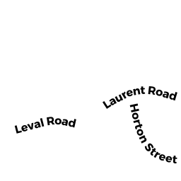
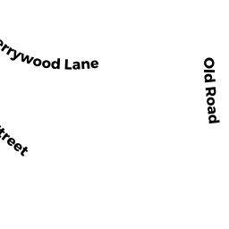
6 HORTON STREET
Owner Information
BOUCHARD FRANCE NICOLE
20 PIERCE ROAD
LYNN, MA 01902


Property Details
6 HORTON STREET is classified as a Three-Family Residential (3 family).
The primary structure on this property was built in 1900. There are 3,420ft2 of built area within this property. There is 3,420ft2 of residential/living space within this property. This property is listed as having 18 rooms. There are 3 units within this property.
6 HORTON STREET is valued at $666,300. The land is valued at $152,100 and the structures are valued at $514,200.
This property is in Zone R. Confirm with local Zoning Board authorities to ensure there are no overlays or other easements on this property.
The most recent deed for 6 HORTON STREET is recorded at the local registrar in Book 14286, Page 572. 6 HORTON STREET was last sold on Monday, January 1, 1900 for $0.
Assessment data from fiscal year 2022.
Flood Data
According to the FEMA National Flood Hazard Layer, this property does not appear to be in a flood zone. It may also be in an area not yet reviewed. Nonetheless, confirm this information prior to taking any action.
To view the flood hazards around this property, create a FEMA "Firmette" Map of the area around 6 HORTON STREET.
Broadband Internet Providers
| Provider | Type | Bandwidth (mbps) | |
|---|---|---|---|
| Comcast | Cable | 1000 | 35 |
| VSAT Systems, LLC. | Satellite | 2 | 1 |
| Viasat Inc | Satellite | 100 | 3 |
| Verizon New England Inc. | DSL | 15 | 1 |
| HughesNet | Satellite | 25 | 3 |
| GCI Communication Corp. | Satellite | 0 | 0 |
Broadband service provider data from December 2020.
Adjacent Properties
- 4 HORTON STREET
Three-Family Residential owned by ONORIO GAETANO - 8 HORTON STREET
Single Family Residential owned by SPECTOR ROBERT - 3 LAURENT ROAD
Residential Condominium owned by HACK NEIL A - 3 LAURENT ROAD
Residential Condominium owned by 3 LAURENT ROAD REALTY, LLC - 3 LAURENT ROAD
Residential Condominium owned by ROCHEVILLE STEVEN - 3 LAURENT ROAD
Residential Condominium owned by ATHANASOPOULOS AGAIA - 3 LAURENT ROAD
Residential Condominium owned by SULLIVAN CHRISTINE M - 3 LAURENT ROAD
Residential Condominium owned by LEPARD DERIC C - 1 LAURENT ROAD
Residential Condominium owned by BROPHY FRANCIS J - 1 LAURENT ROAD
Residential Condominium owned by COMBS THOMAS M - 1 LAURENT ROAD
Residential Condominium owned by JUDD AMANDA LEE - 1 LAURENT ROAD
Residential Condominium owned by SHIRLEY MARIANNE L - 1 LAURENT ROAD
Residential Condominium owned by THIOYE HEATHER MARIE - 1 LAURENT ROAD
Residential Condominium owned by CANAVAN TRACI A